Boundary Waters and Quetico Online Maps
Maps are an important part of your trip into and around the Boundary Waters and Quetico. We are dedicated to bringing you maps that aid as a planning resource. Navigation within the Boundary Waters should be done with quality maps such as True North, Fisher, McKenzie, or Voyaguer Maps.
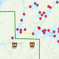
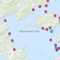
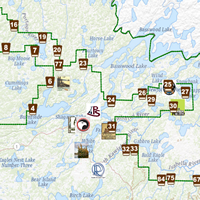
BWCA Lake Maps
View Boundary Waters maps starting at a certain lake or stream. Campsite locations marked and traverse maps with directional arrows.
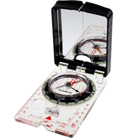
Navigation and Maps Gear
The new and growing gear & business guide! A growing list of products, companies, and services of interest to BWCA & Quetico area adventurers.
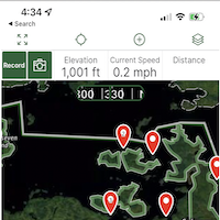
Mobile BWCA Apps
Mobile apps which support offline mapping showing campsites and portages.