Quetico Solo 2011 NcNiece, Burt, and Ted Pt. 1
by TomT
I’m up at first light. It’s cloudy but warm. I made my usual breakfast for this trip which is 2 packets of instant oatmeal with freeze dried strawberries and 2 cups of Maxwell house instant coffee. I use 2 packets for each cup. It hits the spot and is an easy cleanup.
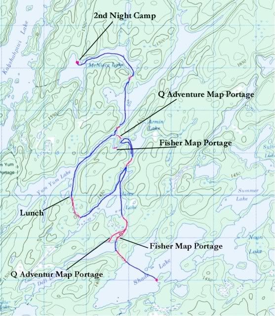
I’m on the water ready to go at 8:30. The other couple who I met yesterday is camped close by on the 4 star site on the middle lake penninsula. I pass their camp and nobody is up. I make the portage into a no name lake then check the map for the portage out.
Here’s where my day starts to go wrong. I carry one main set of large scale McKenzie maps but also have what’s called The Quetico Chrismar Adventure Map as a spare and also a backup to reference portage locations. The Chrismar map is smaller scale and covers the whole park but is known for being very accurate with the location of the portages.
So, I look at both maps for this unnamed lake and the locations conflict. When this happens I always look to find the Chrismar map location first. But it’s nowhere along the north shore. I don’t see it. I do see what appears to be a small campsite with a small fire ring but I don’t see an obvious portage trail. So, I spot the McKenzie map location in the NE bay and go with that.
All is fine and it’s a good trail but I suddenly come to the dreaded T - intersection on the trail. Hmmm. Going left is a strong trail while going right crosses a bog and doesn’t look very used. I see that the McKenzie map trail turns left, so without too much thinking I go left. I soon come to a lake. I see a small fire ring. I look at the map and study the lake features. Yep, it’s the lake I just came from - and now I see it. Down by the waters edge is a small rock pile or “cairn” used to mark trails. This is the portage head marked on the Chrismar map. Doh! Ok, I have a little laugh and then backtrack my way and cross the bog to another no named lake.
I’m mad at myself for wasting time but more importantly using up needless energy turning a 128 rod portage into a 200. A rod is a unit of measurement approx. the length of a canoe and used to measure the distance of portage trails. Anything over 60 rods is a good hike in my book. So, I continue north to the portage to Armin Lake.
Now, I decided last year that I was to solely take my canoe trips in quetico from now on. The BWCA just didn’t have the wildness that I wanted. It seemed overused IMO and was too relatively “safe”. I wanted adventure, so I returned to the less visited and larger Quetico with no latrines and no firegrates at campsites. The trail crews will cut back downfalls but that’s about it. Quetico is wild.
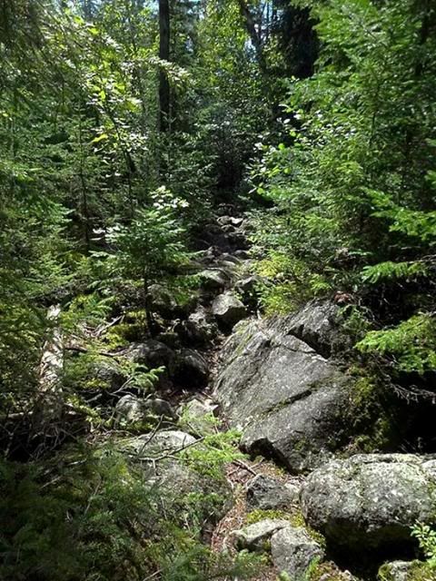
Armin Lake is small and I had 3 maps for it with 2 different portage locations. My problem here was that I simply couldn’t find the portage going out. I went up and down the shoreline and even tested a couple of faint trails that petered out after a few yards. No sign of it anywhere. This is the sort of adventure I wanted, right? Ok then. I bucked up and made the decision to backtrack onto a well used route and get off this out of the way route I was on. I went back south and portaged into Yum Yum Lake. Yum Yum has a reputation of tough portaging in and out and this one was a classic 115 rod Quetico rock garden ankle buster.
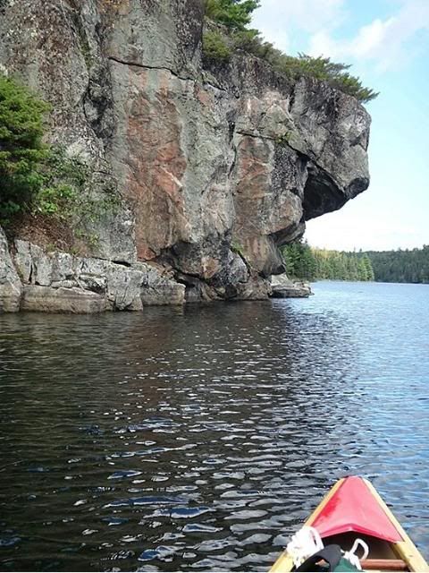
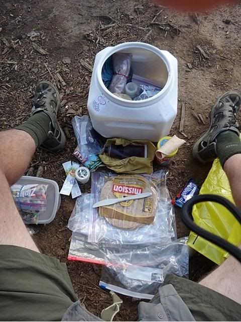
I stopped and ate lunch here of a second turkey sub sandwich. This is the last of my fresh food for the trip and it was good. Along the west shore is a familiar rock face. This, I believe is where the cover for the first BWJ (Boundary Waters Journal) was shot back in 1987. I have the issue but not sure if it was the first one.
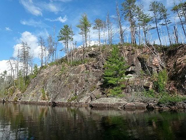
I portage 20 rods into Shan Walshe and notice the shore was recently burned.
I see very large white and red pine trees on the portage into McNiece. This area is known for them. Some can be hundreds of years old and 3-4 feet in diameter. What’s so striking about these trees is their height and lack of lower branches. Just a straight pole going up to 150 feet with a large crown.
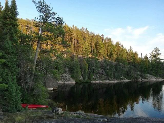
On McNiece I see more fire damage along the shore. The old growth trees seem ok though and stick out. I know of a good site on a penninsula and I find it empty. Actually I haven’t seen sign of anyone today. The site is a beauty with a high overlook of the western bay.
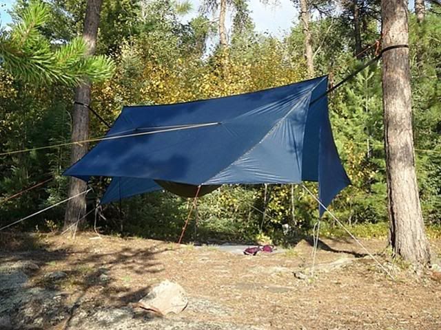
I’m really exhausted at this point. It’s now 4:00. I set up the tarp and then strip down for a quick dive off the rocks. Oh that is great. I’m a modest person but know I’m completely alone on this lake so I dry off naked facing the sun on the rock front porch. It’s a warm, beautiful evening. I dry off and put on clean clothes and dry shoes. I find a great spot in back up high for the tarp.
Too tired to cook I break out P& J on tortillas with trail mix on the side for dinner.
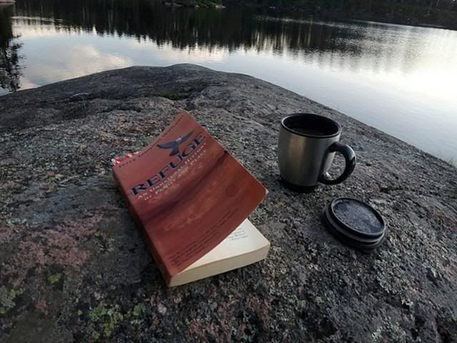
As the sun goes down I pull out my book, a very good one recommended by BWCA.com member Tremolo, and sit on the porch with a mug of hot chocolate.
As I sit a low pitched screech breaks the silence. I’ve never heard this sound before. It’s from on my shore a little ways down to the north. I hear it again and its very loud. Must be a bird of some sort. I look closely in the trees for any movement. Suddenly it bolts from its perch and flies across the lake. I don’t get a good look at it but it flaps its wings very fast. My guess is that it’s an owl.
I had another wildlife encounter today also. On a portage I walk by two grouse. They are like small chickens and hop out of the way but don’t stray far. I stop to look and they just watch me from 15 feet off the trail. I bet the natives had many grouse dinners with their bow and arrows. Easy pickins.
My weather radio says it’s going down to the low 30’s tonight. Gonna have to wear the long underwear and fleece hat to bed. I sleep well tonight.
 Donate - BWCA.com