Quetico August 2008
by Ho Ho
This episode of the Quetico August 2008 Pictorial Trip Report is dedicated to the Spartans and to Leslie, whose giving spirit is a model for us all. Here's to a speedy recovery for Neil and Leslie, and a wonderful summer trip in the Boundary Waters for Neil and Lynda. With Love and Prayers, Ho Ho and David
Day 4 (August 18, 2008): Campsite - Baird Lake - Portage - Cutty Creek - Cub Lake - Portage - Cutty Creek - Eag Lake - Portage - Cutty Creek - Portage - Cutty Creek - Beaver Dam Liftover - Cutty Creek - Camel Lake - Portage - Camel Creek - Portage - Camel Creek - Lining/Liftover - Pond - Portage - Veron Lake - Campsite - about 12.5 miles altogether:
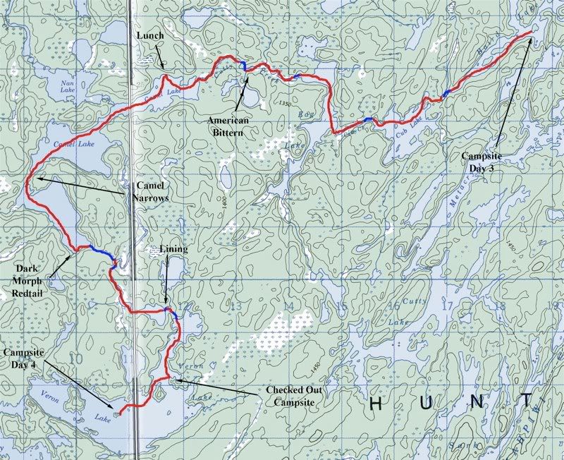
We got up around dawn at our island campsite on Baird Lake. There was a nice view from our kitchen rock -
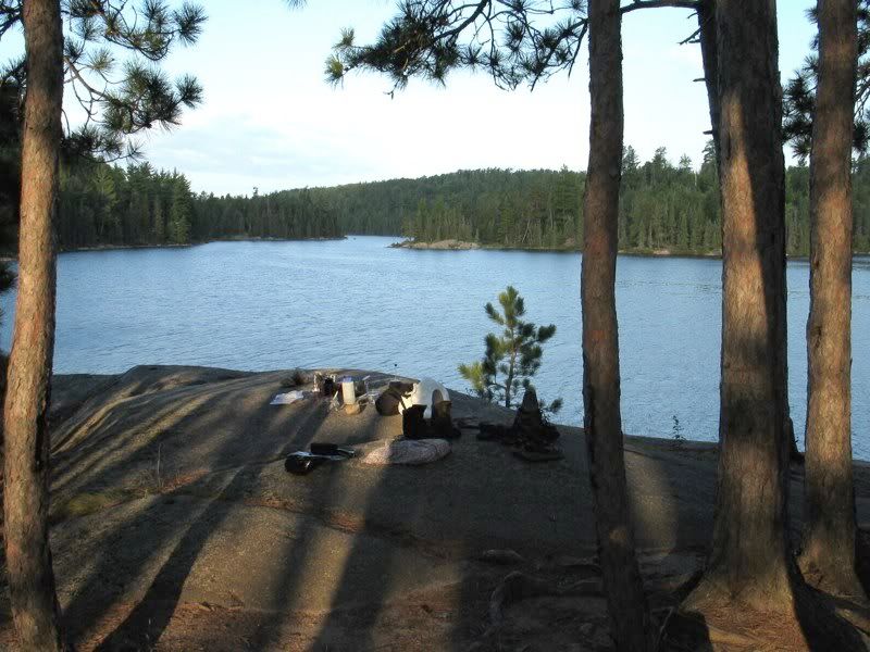
Over coffee David got out the map to preview our route, and I traced out what I had in mind. He was like, "You mean we're going down that little creek?" -
While we were cooking breakfast, a two-man canoe passed by coming from the south end of the lake. Once again we were baffled by how much earlier other paddlers get on the water than we do. We also wondered if the duo had camped on Baird. It sure felt like we had the lake to ourselves overnight. We'll never know the answer, because we just waved hello as they went by. Those were the last people we would see for a couple days.
After breakfast I walked around our campsite island. The open Red Pine forest made for easy walking the length of the island, which humped up to about 50 feet above lake level, with good views in all directions. We also went for a quick swim. Then we got on the water about 9:30 - pretty early for us.
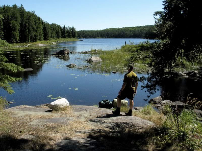
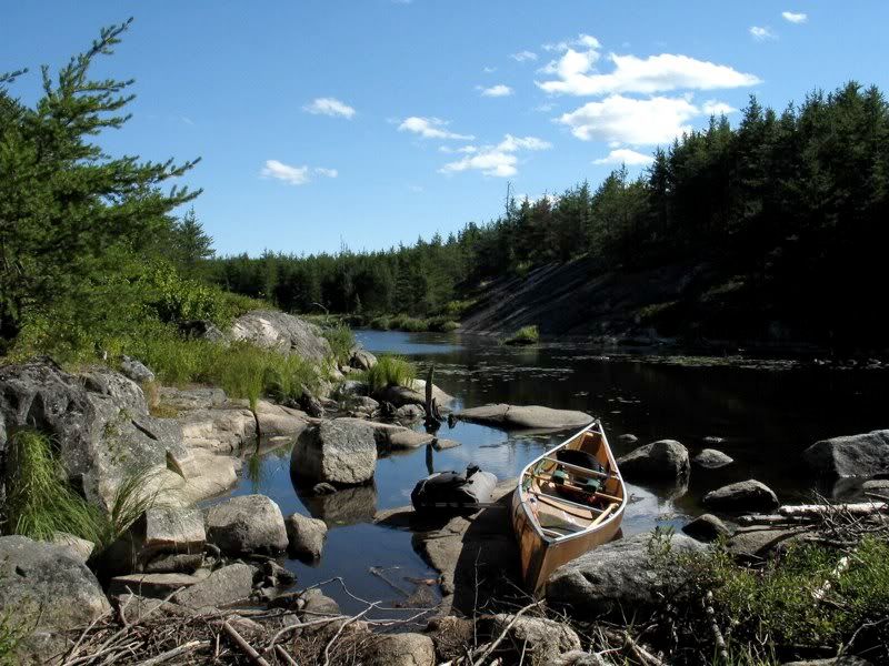
We paddled south down the lake toward the outlet to Cutty Creek. Along the way we passed another island campsite, which looked pretty nice from the water (maybe the two guys we saw earlier had been camped there?). Soon we arrived at the portage from lake to creek. We had to maneuver around a downed log that was sprouting vegetation to get to the portage landing. Looking back after unloading -

This portage is not too long, but it drops steeply. Before leaving on this trip, I had been assured by several people that Cutty Creek would have enough water for passage, despite the dry weather of the second half of the summer. As we started down the narrow, vegetation-choked creek, I hoped they were right -

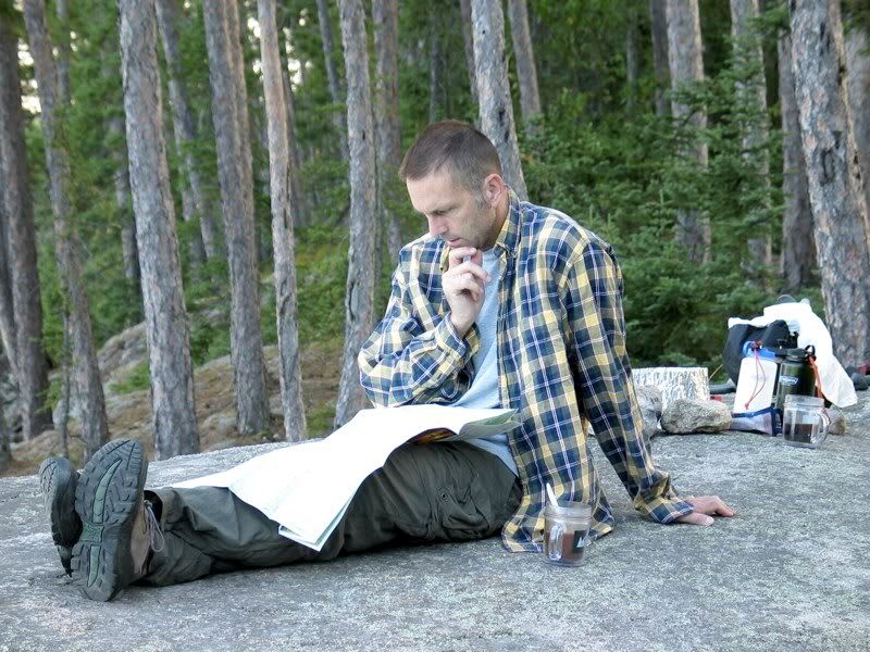
Our heroes on Cutty Creek -
It wasn't far to Cub Lake. These cliffs signal the approach -

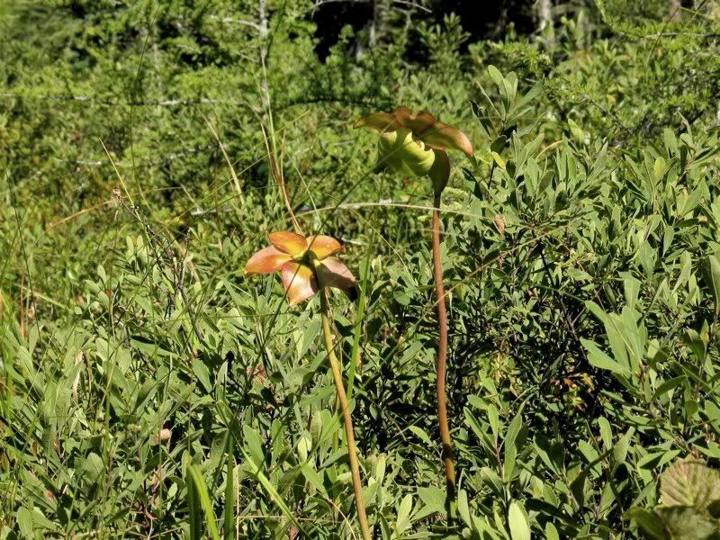
Pitcher Plant flowers lined the boggy creek edges -
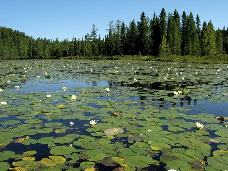
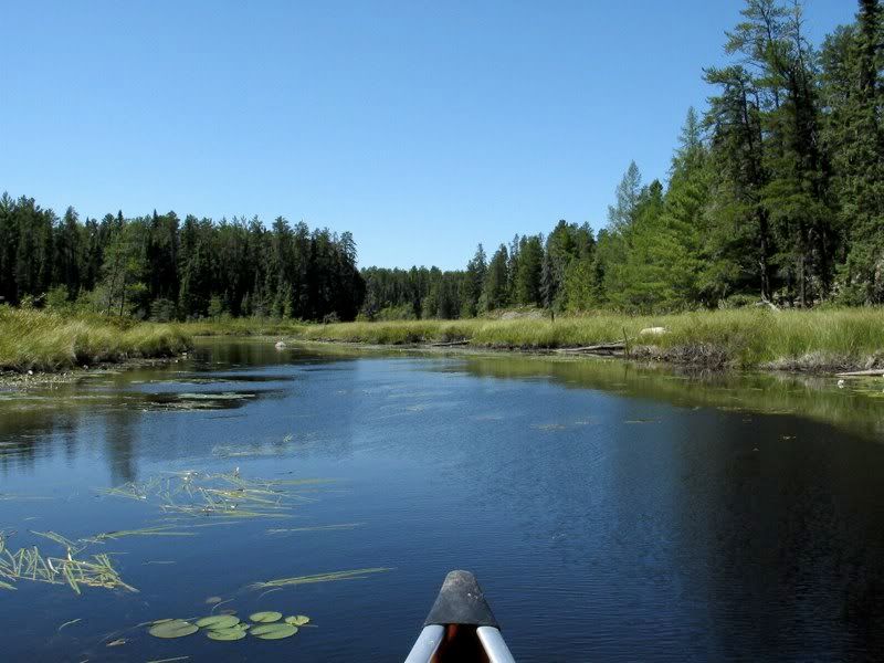
The creek widens and is filled with Water Lilies as it empties into Cub -
We followed the north shore of Cub Lake to its west end, where there is a portage around the first, rocky part of the creek as it resumes its downstream journey. After unloading the packs, for some reason I decided to "float" the canoe instead of carrying it. There was less water and less floating than I thought when I started out -
As a bonus a Pine Siskin hopped around on the rocky creekbed while we loaded up at the end of the portage. From there, the creek continued as a wide but very shallow channel filled with Water Lilies -
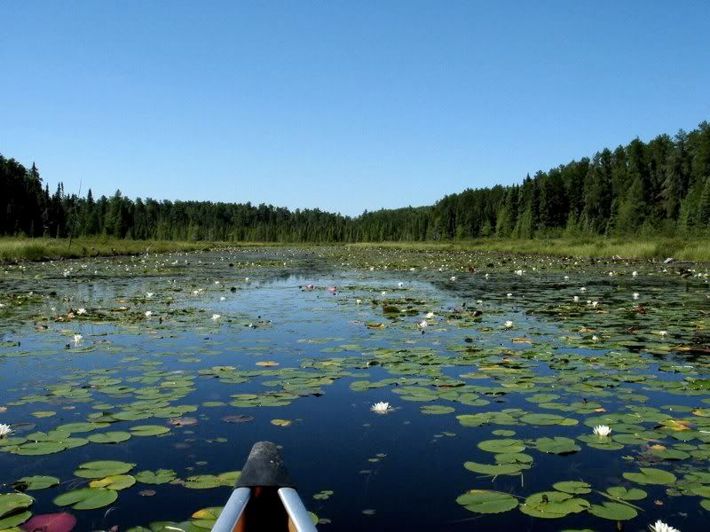
It was tough paddling in this stretch because it was so shallow. Our paddles only went a few inches into the water. But we mostly stayed afloat over the muck, with a few notable exceptions when we briefly got stuck on hummocky mounds just below the surface.
In a while we came to Eag Lake. There we had a short paddle into the face of a brisk north breeze. The wind had shifted from yesterday's south wind, which had blown us northbound on Keefer and Sark when we really needed it. After a bit we turned westward again, into more sheltered water leading to our next portage, from Eag back into Cutty Creek again. This picture is from the portage landing looking back toward Eag -
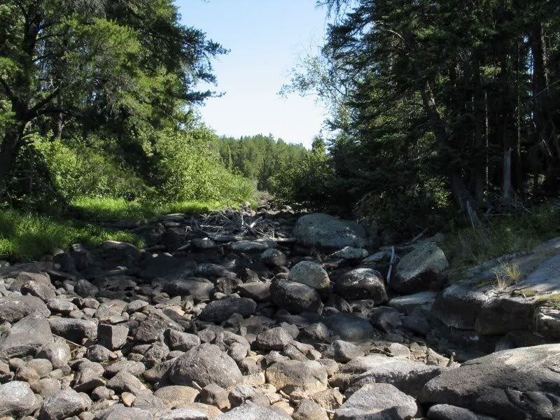
The portage goes around "rapids" that were bone dry -
From Eag to Camel Lake is the longest stretch of creek paddling along Cutty Creek, broken up by one more portage and a beaver dam. The creek starts out deeper and clearer here than earlier sections, with a nice sandy bottom -
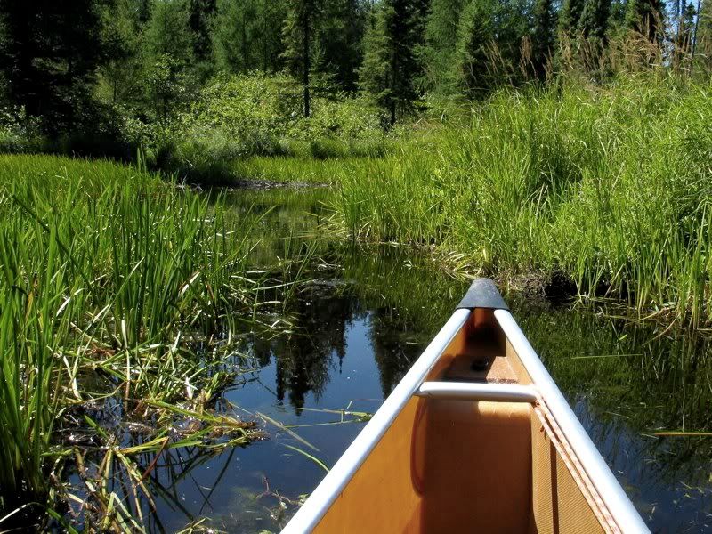
But there are also some spots where you start to wonder if the creek is just going to disappear on you -
As we paddled through a marshy stretch, we were startled by a large bird flushing from the reedy vegetation. Its streaked brown plumage, long neck, wide wings with dark feathering below, and coarse croak as it flew off, all betrayed its identity as an American Bittern. Contrary to what it's name suggests, the American Bittern is not a rural bird that clings to guns and religion. (Just a little humor there - don't take it seriously.) No, it's a member of the heron family - the only one besides the Great Blue Heron that makes it up to Canoe Country. American Bitterns aren't that uncommon, but they're so furtive and well-camouflaged in the reedy marshes where they spend their time that you don't see them very often. Normally when they are alarmed they stick their bills into the air and the streaking on their necks and bodies blends in with the vegetation where they're hiding. They rarely flush like this one did. Anyway, this was the first Bittern we had seen in Quetico-Superior, so we thought it was pretty cool. (Bonus fact - the very similar European Bittern is called a Rohrdommel in German. A typically hilarious German name.)
In an odd coincidence, after we were back from this trip but still in the Ely area, we happened upon another Rohrdommel while canoeing along a marshy stretch of local lakeshore. This Bittern behaved much more like they are supposed to - instead of flushing, it tried to hide by standing vertically in the reeds. We got some good views of it from the canoe for ten minutes or more. The pictures from the point-and-shoot weren't great, but here's one (look closely - the camouflaged body of the bird goes to the bottom of the picture) -

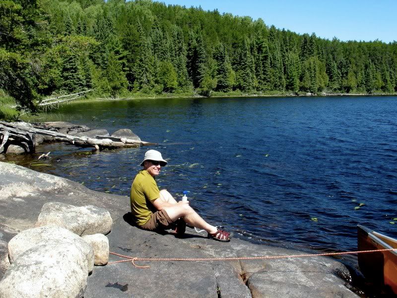
Back on Cutty Creek, we continued downstream and got to Camel Lake around 1:00, when we headed for a small campsite on the north shoreline for lunch. While we ate we took refuge from the sun in the dense forest. I filtered some water before we launched again -
While eating lunch, we decided we would aim for Veron Lake to camp. That meant we still had some significant paddling and portaging to go. We sped down the north half of Camel Lake, helped along by the wind that was now blowing at the perfect angle from the northeast. I was starting to think of this as "the trip of favorable winds." (But as our experience with the wind would prove later in the trip, only a fool generalizes about a Quetico trip before it's over.)
As soon as we turned into the narrows to the south part of Camel, we were out of the wind and the bright sun beat down on us from the cloudless sky. My navigation from here was a bit off-kilter, because we hit the south end of the lake a little west of the portage landing. But that was okay, because just as we realized we were not quite where we should be, we noticed a Buteo soaring overhead. At first I thought it was a Broad-winged Hawk, which is common in these parts. Then a loud Keeeeeerrrrr revealed that it was actually a Red-tail. Yet its plumage was completely different from the ordinary morph of Red-tailed Hawk found in the eastern half of North America, which is a light- colored bird when seen from below. This bird's body and much of its wing's were black, and there was barely any (maybe no) red on its tail. It was probably a dark-morph Red-tail from western North America. Or, possibly, it was even a Harlan's variety of Red-tail - which is black and white and has no red in its tail at all - gone off-course during fall migration. Either way, this was another very cool bird sighting for the day.
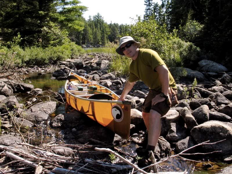
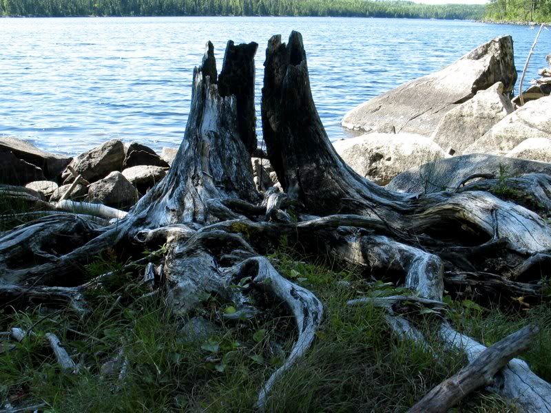
The Red-tail without the red tail circled out of sight, and we paddled over to the real portage landing. There we found this "blackened stump bleached by the sun" (to quote a favorite Ian Tamblyn lyric) -
This portage would be the longest of the day, clocking in at a half mile. I knew someone had told me something about it, but at first I couldn't remember what. As I started climbing steeply uphill during the first trip across, it came back to me - the portage goes steeply uphill. Then it gradually descends again to the creek.
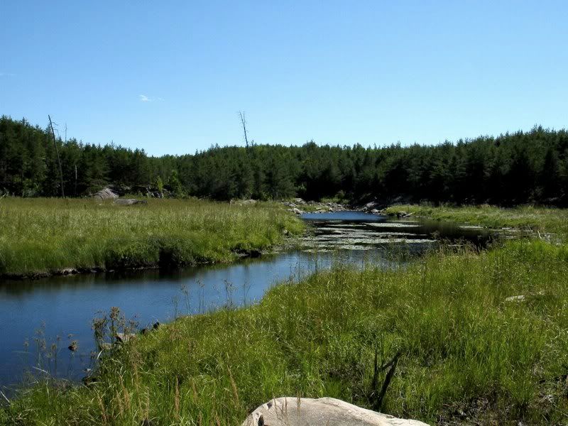
This was a different creek from the one we had followed downstream all morning. Cutty Creek exits north from Camel Lake, flowing into Fred then Sturgeon Lake. Now we were portaging to a creek that flows from Veron into Camel Lake. I haven't seen a name for it anywhere, so I just call it Camel Creek. At the end of the portage from Camel Lake, you come to the creek in an open grassy area, where we flushed a couple skittish Mallards. The surrounding forest in this area had burned maybe a couple decades ago -
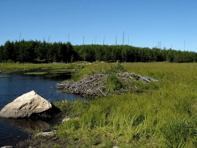
The next portage is just a spit away - you can see the rocky stretch it goes around in the picture above. We loaded up, paddled a hundred yards or so, and unloaded again next to a Beaver McMansion -
This short portage goes mostly through tall grass by the edge of the creek, then through the woods for a few rods, before ending just above a big old beaver dam -
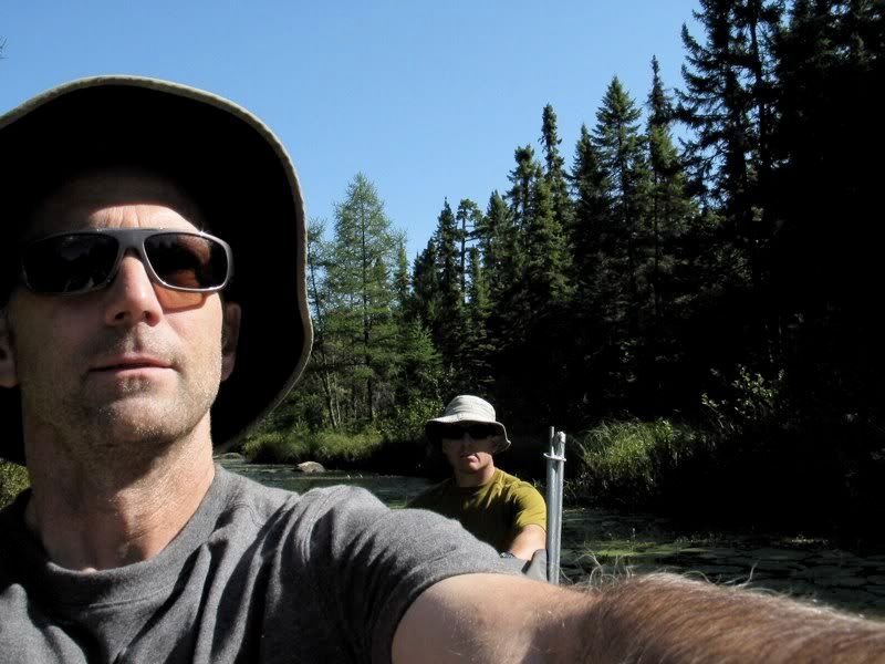
From there we paddled upstream about a mile. Eventually the creek widens into a pond, then goes through a rocky narrows where we first had to get out and line the canoe and then unload the gear to get across the last couple rocky rods. A few paddle strokes beyond there and we came to the last portage of the day, into Veron Lake. This is short portage through a thick, dark forest.
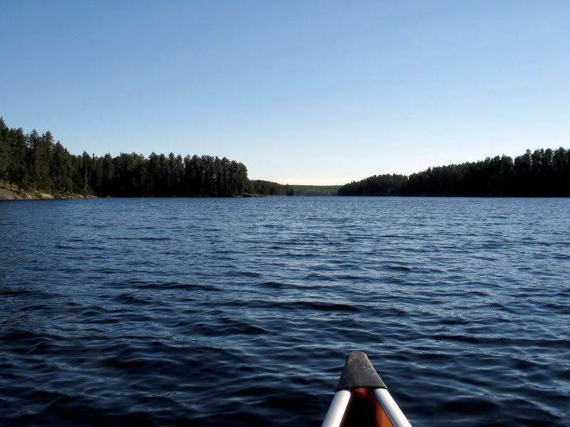
After that carry, we started down the long north arm of Veron -
It was getting late, so now we were on a mission to find a campsite. I had a few possible sites from the PCD marked on the map. We stopped first at a point at the south end of Veron's long north arm where it meets the main body of the lake. We weren't too impressed with that site, although it would do if we didn't find anything else. But we decided to check out the small island in the middle of the lake where there was supposed to be another campsite. We got there about 6:00 and decided to stay.
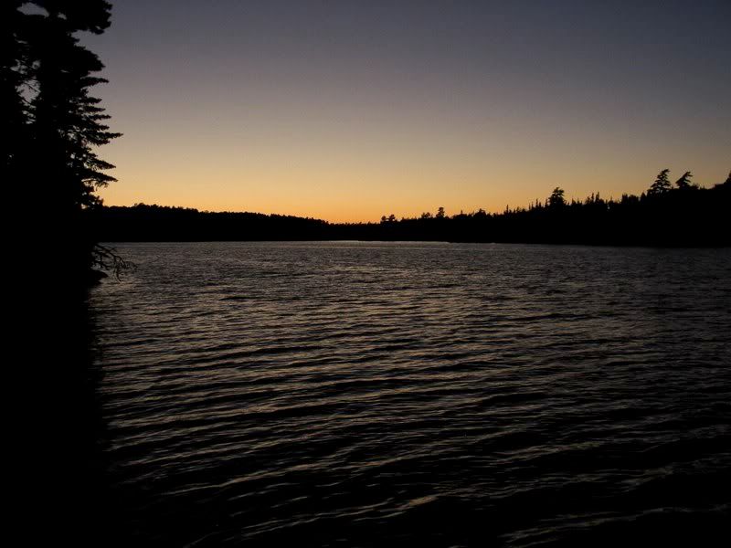
This was not my favorite campsite of the trip, though it had nice aspects. The area around the fire ring was kind of trampled and wide-open to the east, and the wind had now shifted around so that it was coming straight from that direction. After a couple very warm days, it suddenly seemed very cold in the brunt of that wind. We actually had to use our towels to dry off after our swim, instead of just air drying like we normally do. But otherwise the site was pleasant and not too heavily used. There was a nice rock to sit on down by the water on the north side of the island out of the wind, where we ate our dinner and later drank some Maker's Mark. This is the view to the west from our leeward rock as the sun set while we were sipping whiskey -
We hit the sack as soon as it was dark. The wind kept blowing all night. Around 3:00 I woke up and thought it was starting to rain. It was just the wind. But since we didn't have the fly on the tent, the feeling that it was about to rain kept me tossing and turning the rest of the night.
 Donate - BWCA.com