|
 Boundary Waters Quetico ForumTrip Planning ForumNorth Cone to Davis vs North Cone to Cliff?
|
 Forum Sponsor

Author
Text
")
01/01/2010 12:32PM
I'm looking at loop options, one of which is entering on Brule then heading north through the cone lakes and Kisdadenna eventually ending up back on Brule via South Temperance. My question is about the routes out of North Cone. What are the pros and cons of going north to Davis Lake vs east to Cliff, Wanihigan and Winchell? Has anybody used these routes? I've always done easy routes near the edge of the BDub that my family and friends wanted to do but I'm 50 years old and I want to go deeper in while I have a chance. Thanks in advance for the any help.
Reply
Reply with Quote
Print
Top
Bottom
Previous
Next

01/01/2010 01:08PM
Depends on what you want. I've never been to Davis, so I can't comment on the scenery, but I think you'll have solitude there, as well as a couple of gnarly portages.
On the other hand, IMO I think Cliff lake is one of the prettiest in the BWCA. Winchell is very, very nice too. You will see other canoists for sure...in fact if you want to camp on Winchell plan on stopping early.
On the other hand, IMO I think Cliff lake is one of the prettiest in the BWCA. Winchell is very, very nice too. You will see other canoists for sure...in fact if you want to camp on Winchell plan on stopping early.

01/01/2010 05:34PM
The portage into Davis from N Cone is a real rock garden.....just so you know. Cliff is beautiful, and the Cones are very "moosey". The campsite on S Cone is a winner. Here's a shot of the cliff on Cliff.

And the stream connecting the Cones...


And the stream connecting the Cones...

~On to Fort Chipewyan before the snow flies!

01/01/2010 08:01PM
I did it both ways this year. In June we came thru Kisk to Winchell, the Cliff route to the Cones and out to Brule. In Sept we came from S. Temp. to Brule, Cones, then into Davis for a day, then took the 323 rodder to Kisk. That 323 was a real adventure. Double portaging (leap frogging) took us just over 2 hours. Big hill climb at start, fairly level on top, then gets a little more varied and rugged as you get closer to Kisk. The 147 from North Cone into Davis is a big rocky hillclimb at the start and end with a fairly level top part through a big pine forest. I have not published the trip report yet.
The portages through Cliff are rocky but dont have near the elevation changes....it's an easier route by far. Not sure of the rest of your route, but the 190 from Kisk to Muskeg has a big elevation change too....."the wall"...but it's downhill to Muskeg.
The portages through Cliff are rocky but dont have near the elevation changes....it's an easier route by far. Not sure of the rest of your route, but the 190 from Kisk to Muskeg has a big elevation change too....."the wall"...but it's downhill to Muskeg.


"What could happen?"
01/01/2010 09:24PM
I have done both. Davis is a very pretty lake, many islands, and only a couple of campsites. The portage going north used to be a beauty, but it got hammered by the '99 storm and is now very sunny and overgrown with brambles and brush (but maintained by the forest service). Going into Winchell lets you see about 5 or 6 very pretty lakes, with some rocky portages connecting them. If you have the time, the cliff on the south side of Winchell about 1.5 miles from the portage gives a great view. Find the canoe landing and angle towards the face of the cliff to find the best trail up. Good luck with the wind on Brule.
01/02/2010 07:50PM
Thanks for the help. I applied for the lottery today for entering at Brule. I'd love to see Davis but it depends on my wife and how she feels. If when we get onto North Cone she feels like a challenge we'll go for it and plan to spend a couple days there. If not then Cliff will be great too. It's nice to have options. Regarding the wind on Brule, we've been there before. We'll be sitting at the EP with the canoe loaded,sipping our coffee when the sun comes up.
01/06/2010 03:39PM
You pretty much have good information on all the portages. However, one thing that I didn't see mentioned is the Cavity Lake fire that went through the Davis Lake area several years ago (2006 I believe). I was there the next summer after the fire. Most of the west end of Davis was burned up and the two campsites destroyed. I'm sure the sites have been repaired or moved by now. The east site was in the best condition but the site at the far west end of the lake was totally burned up. I would imagine the blueberry picking will be awesome this coming summer though.
The portage into Davis from North Cone is VERY rocky as stated, be careful. As also stated in some of the other comments, if its solitude you seek the route through Davis is the way to go. If you choose the eastern route through Winchell you be sharing it with lots of other paddlers. But, I will add the east way is one of the most beautiful routes in the BW. Hope this helps. Happy Paddling.

The portage into Davis from North Cone is VERY rocky as stated, be careful. As also stated in some of the other comments, if its solitude you seek the route through Davis is the way to go. If you choose the eastern route through Winchell you be sharing it with lots of other paddlers. But, I will add the east way is one of the most beautiful routes in the BW. Hope this helps. Happy Paddling.


John 14:6
01/06/2010 09:06PM
preacher,
Thanks for the update on Davis. I was not aware that the fire did so much damage there. That is one of my favorite lakes I've been to and it saddens me to see what happened there. The good news is that the forest will regrow and life will go on there.
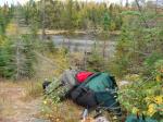
Davis north campsite before the fire:

Another note about routes out of Brule. In 2008 Grassy Lake was drained and made for an incredibly difficult bushwhack around it. Anyone know if the beavers are back and the water is up?

Thanks for the update on Davis. I was not aware that the fire did so much damage there. That is one of my favorite lakes I've been to and it saddens me to see what happened there. The good news is that the forest will regrow and life will go on there.
Davis north campsite before the fire:

Another note about routes out of Brule. In 2008 Grassy Lake was drained and made for an incredibly difficult bushwhack around it. Anyone know if the beavers are back and the water is up?


01/06/2010 09:53PM
DTO...that site was kind of spared....it's a little more "airy"...but still ok. Going through Winchell last June, I talked with some people who took the Grassy route....they said it was still a muddy mess. (in June with decent water depth)
"What could happen?"
01/07/2010 09:09AM
DTO,
Cowdoc is right that sight was spared and I'm sure is in fine shape. The east half of the lake was spared as well so it still beautiful.
Thanks for the info on Grassy. I didn't know it was in that kind of condition. I like to take my groups through there so I'm glad you made me aware of its condition. I did guide a group into Winchell last September but for a change of pace we entered at Popular and traveled south to Winchell. The whole time I'm thinking "we could have got here in half the time if we would have entered through Brule." Now knowing about Grassy I'm glad we didn't. This group had several older men that might have not enjoyed bushwhacking around Grassy.
Here's a pic from a cliff on the south shore of Winchell

John 14:6
01/08/2010 05:35PM
preacher,
Excellent photo, thanks for sharing. My wife and I stayed a night on Winchell (toward the east end) in 2008. While we camped I thought seriously about going across and climbing up that cliff but had places to go and things to see. I now regret not doing so. How long did it take you to get up there?
Excellent photo, thanks for sharing. My wife and I stayed a night on Winchell (toward the east end) in 2008. While we camped I thought seriously about going across and climbing up that cliff but had places to go and things to see. I now regret not doing so. How long did it take you to get up there?
01/10/2010 04:21PM
Great photos. Not much I could add except wearing at least 8 inch high boots laced up tight might help with some of the ankle turner portages. I know as I get older some of these portages will sadly be crossed off my list.
"Did you bring the coffee?" "No. I thought you were."
01/10/2010 05:37PM
DO,
I don't think it took real long, maybe 20-25 minutes. I know how you feel though, I've hesitated taking the time to stop and see the sites sometimes, but I've never regretted it when I did.
There is another great cliff worth climbing on Winchell west, in the bay headed into Omega Lake. It's got a nice view as well. If you go to my website the cover page has a pic from the top.
www.pathandpaddle.org
There are some other nice photos from the top of the first cliff (the one you inquired about)including a cave we found on the way to the top. Here's the link
http://picasaweb.google.com/darrenfyoung/LakesFree2009?feat=directlink
I don't know if that link works or not. If not just go to google, then photos and search Lakes Free 2009 or my name Darren Young.
Does anyone know if you can paste a link in these fields?
John 14:6
01/11/2010 04:38PM
Darren Young
Yes....you can paste a link (hope you don't mind). When you REPLY, just go to the "add a link" tab and follow instructions.
"What could happen?"
02/06/2010 10:17PM
I've done both. I like the Cliff lake route better. Both are steep and rocky. I find Cliff to be one of the most beautiful lakes. The cones are right up there too. The drawback of going through cliff is the grassy lake problem.
Reply
Reply with Quote
Print
Top
Bottom
Previous
Next

Subscribe to Thread
Become a member of the bwca.com community to subscribe to thread and get email updates when new posts are added. Sign up Here
Community Links
 Search BWCA.com
 Donate
 Featured Sponsor
