|
09/06/2019 11:52PM |
- GPS File Depot Website with numerous topo maps and more. Can sort by region
- Portages and Campsites file Icons converted to tents for campsites and hiking path for portages
If anyone has files to share via google drive, one drive, or websites, reply to this thread and I will add them to the first thread!
|
08/17/2021 07:42AM |
Linkage
|
05/03/2021 07:49PM |
I have been working on a map for my June trip using QGIS and other software. You can add layers such as satellite images and campsites and you can zoom in to find shallow reefs.

What chartplotter are you using?
|
03/16/2020 09:53AM |
.gpx files
.kmz files
butthead
|
02/11/2020 09:09AM |
|
12/11/2020 10:29PM |
Question: Does anyone know how to view satellite imagery in the Basecamp app without connecting a GPS device and downloading Birdseye maps? I'm using this in a non-prescribed way with my new touchscreen Garmin chartplotter/sonar, which does not "connect" to my computer like a handheld GPS might. I don't need to get the satellite images onto my chartplotter, I just want that layer visible in Basecamp for scouting purposes. Easy to see sandy -vs- rocky shore, sunken islands and reefs, etc.
Alternatively, any recommendations for a different app or website that has satellite imagery and allows creation an export of GPX files full of waypoints? For now I'm using Google Earth, exporting KMLs, converting to GPX, editing the icon tags in a text editor, and then importing the GPX into my chartplotter. It's a production :)
Thanks!
|
02/11/2020 09:48AM |
RC: "I think the link to the portages campsites file is broken, or is it my pc?"
You may have them but will repost my files. GPS files for BWCA Quetico from my personal "OneDrive". I only keep public files and photos here.
butthead
|
01/17/2020 09:17AM |
USGS topoView - Download the most recent and historical USGS topo maps in a variety of scales and formats.
|
01/28/2022 09:44AM |
arnesr: "theguildedgopher, I'm not a basecamp expert, so I can't help you there. Have you tried QGIS? It has a learning curve to it, but it can do what you describe.
I have been working on a map for my June trip using QGIS and other software. You can add layers such as satellite images and campsites and you can zoom in to find shallow reefs.
What chartplotter are you using? "
It’s been a while since I’ve check this forum, but thanks for the ideas — I’ll look into this for sure.
Im using a garmin echomap 93sv+ — it’s mounted in my fishing boat that I use on basswood, sag, etc.
|
09/07/2020 08:15AM |
TechnoScout: "Ahhhhh...I get it!!
Thanks butthead and schweady!
Tools>>arrow! Got it!!!"
:-) Yeah, I guess the menubars are quite different between platforms. On the Mac version, the arrow is chosen with Tools > Selector...
Glad you got it figured out, but also I have to add this P.S.:
With a map like 'BWCA Camps & Portages' loaded to your handheld, there is no need to add sites and portages for each trip, saving a lot of time and device storage space.
|
09/06/2020 08:11AM |
butthead: "RC: "I think the link to the portages campsites file is broken, or is it my pc?"
You may have them but will repost my files. GPS files for BWCA Quetico from my personal "OneDrive". I only keep public files and photos here.
butthead"
Butthead...any clever way to trim the campsite/portages by area? I can delete them one at a time or by groups (in numerical order) in Basecamp, but I see that there are random campsite numbers here and there unrelated to any geographic order.
For example...if I wanted all of the campsites from Birch through Knife and down to Kek.
Basecamp does not appear to have an "area" select.
|
09/06/2020 12:55PM |
Anyway you can select an area in Basecamp then export the selection to a GPS. Tab tools then select for a selection arrow. outline your desired selection.

Tab file, select export, save the export file
 show here on a blank map,
then on a MN topo map from GPS File Depot,

Hope that helps some.
butthead
|
09/06/2020 05:29PM |
TechnoScout: "butthead: "RC: "I think the link to the portages campsites file is broken, or is it my pc?"
You may have them but will repost my files. GPS files for BWCA Quetico from my personal "OneDrive". I only keep public files and photos here.
butthead"
Butthead...any clever way to trim the campsite/portages by area? I can delete them one at a time or by groups (in numerical order) in Basecamp, but I see that there are random campsite numbers here and there unrelated to any geographic order.
For example...if I wanted all of the campsites from Birch through Knife and down to Kek.
Basecamp does not appear to have an "area" select."
In the menubar at the top, choose the arrow, then draw a rectangle around the general area desired. You can always add or remove sites or portages in the list on the left column by holding the command key and selecting. (This is on an iMac. Your method may vary.) Make a new list to hold the chosen subset for future use.
|
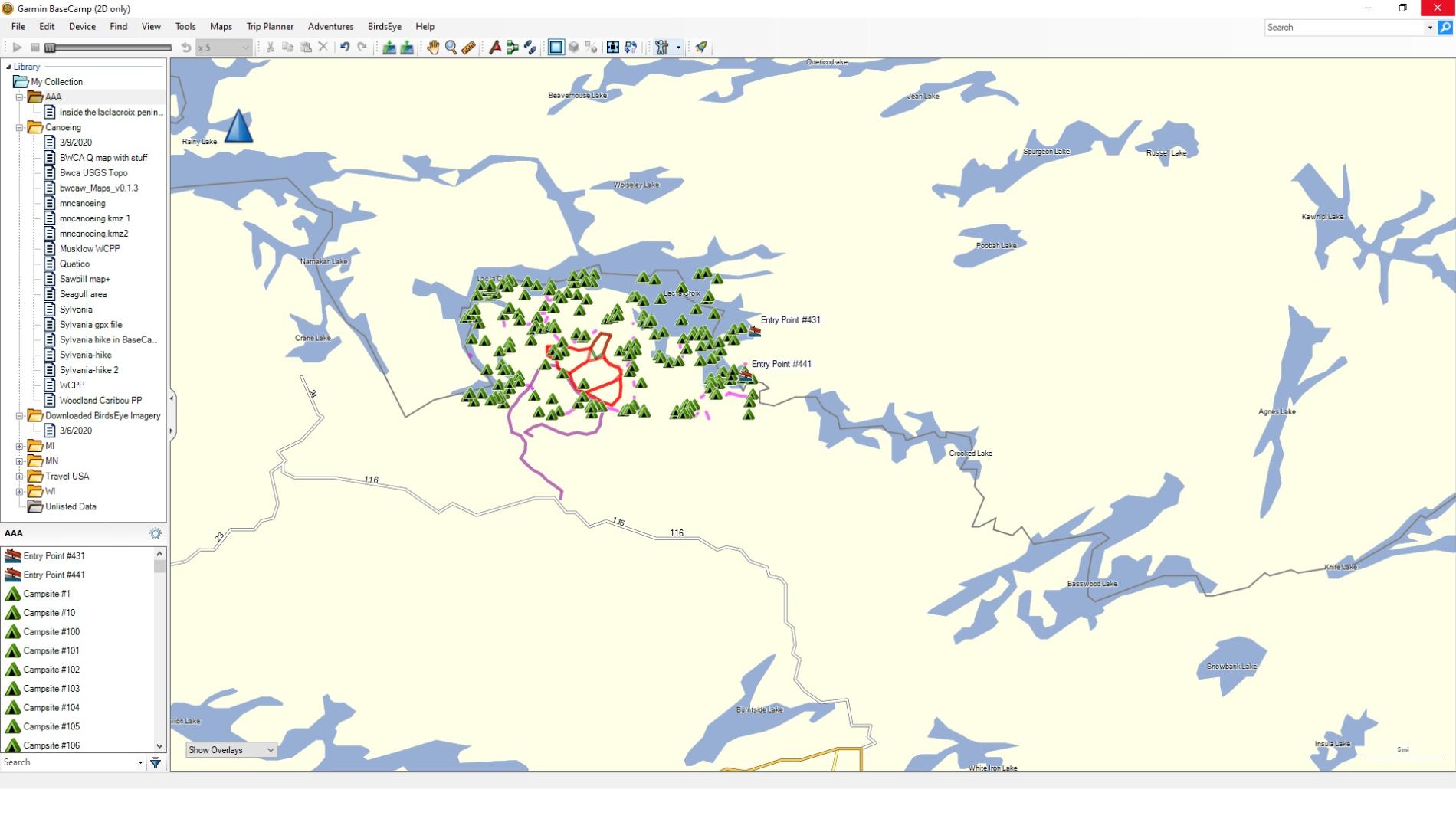
09/06/2020 09:28PM |
I wonder if there is a difference in the PC and MAC interfaces. Here is what I see.

|
09/06/2020 09:31PM |
Thanks butthead and schweady!
Tools>>arrow! Got it!!!
|
09/08/2020 05:16PM |
schweady:"
With a map like 'BWCA Camps & Portages' loaded to your handheld, there is no need to add sites and portages for each trip, saving a lot of time and device storage space.
"
Yup, this is what I do. I have the transparent camps & portages loaded onto my handheld and then make waypoint marks for specific campsites or spots based on pre-trip research.