Boundary Waters Canoe Area (BWCA) and Quetico Home PageBoundary Waters outfitters provides gear, permits, and guides.Boundary Waters - BWCA - Lodging, Resorts, B&BsBoundary Waters (BWCA) entry pointsBoundary Waters MapsBWCA and Quetico Park Books and MagazinesContact www.BWCA.com


Quetico - 17 Day Solo (Part 1 of 2)
by PineKnot

Trip Type: Paddling Canoe
Entry Date: 07/10/2011
Entry & Exit Point: Quetico
Number of Days: 17
Group Size: 1
Trip Introduction:
Part 1 of 3


Introduction.

This past winter was excruciatingly long. But summer has finally arrived and it's great to be alive! I planned a fairly rigorous 3-week solo adventure, looping from Prairie Portage through Shan Walshe, up the Kahshahpiwi chain to and Baird, west on the Cutty Creek to Camel followed by a bushwhack into Hoare. After a couple days of ultimate solitude and trout fishing, I’d bushwhack back to Camel and then turn south to Delahey and the famous Olive Jar which would begin a more relaxed second half trip pace that would take me back to Prairie Portage.

I decided to first complete a 6-day solo up to Marj starting July 1 to test out some new gear and see how my surgically repaired knee would hold up. The November surgery removed a painful bone spur under the kneecap and numerous “floaters” of cartilage. Afterwards, the doc said the surgery went well, but most the cartilage in the knee was pretty much gone. No more high impact activities like jogging and running stadium stairs. I spent a couple months wearing a brace and strengthening the muscles and tendons above and below the knee. I wondered how the knee would do on portage trails with 80+ pounds of packs and canoe.

The 6-day trip went poorly, the knee swelling up on Day 1 as I made my way toward Sarah Lake. Never made it to Marj, and even after laying over on McIntyre on Day 4, the knee never recovered. I exited Quetico frustrated, disheartened and physically hurting. As I drove the 4+ hours to Eagan to rest and visit my sister and her husband for a couple nights, I tried to think of alternatives to the 3-week solo. With the knee throbbing on the drive down I-35, I wasn't sure what I should, or could, do.

Still determined to make something of my longer solo, I cut it down to 17 days, with ample layover days to rest the knee. This revised trip would be about lounging, exploring, fishing and enjoying the sight and sounds of the great Northland, bad knee and all. I’d head to Kahshahpiwi and then turn west into Marj, up to Suzanette, and back down to Prairie Portage. I pared down the food pack and left behind the McKenzie maps and other info for the northern route to Camel and Hoare. They'd have to wait for another year. As I finished loading my gear into the car, the last thing I did was grab my knee brace and put it on top of the pack. Prior to leaving Ohio, I had tossed it in the trunk (in the back of my mind, I suspected my knee would have problems). As it happened, $20 brace from Walmart became the single-most important piece of gear during my 17-day solo.

Day 1. Prairie Portage to Shan Walshe via Shade

Total Miles: 14.2 12 Portages (2880 yards)

My adventure begins. It's almost 5:30 as I wind my way up Highway 169 into Ely. The morning mists are slowly dissipating as the sun begins its climb above the treeline. It looks to be another calm, sunny morning in canoe country. I just love driving into Ely at sunrise.

First stop. Britton’s for a hearty breakfast of eggs, sausage, wheat toast and orange juice. There's a group of 6 guys getting ready to eat and a couple of younger men at the adjacent table. I eat rather quickly, then hop in the car and call my wife. The last thing I tell Jen is to watch the SPOT on Day 3 or 4. I should be on Kahshahpiwi and heading west from there. If I head north, that’ll be your sign my knee must be feeling better for the run up to Camel. Last thing I tell her is “I love you” and I turn the phone off and begin the drive to LaTourell’s for my tow to Prairie Portage. I feel different. Not excited as I normally am for my solo trips. Anxious is more like it. All about the knee, which actually feels better today than it has since entering Quetico back on July 1.

My route for Day 1 is the same I had done with my son a couple years ago. I expected to stop at Shade or Grey, but with little wind and temps in the 70s, I pushed it a little further.


View 2011 Day 1 in a larger map

I park on the packed gravel in the front of LaTourell’s, unload the canoe and all my stuff (and there’s a lot of it) onto the dock and reach Prairie Portage at 7:30. I busily attach the yoke pad and lash the spare paddle, camp chair, fishing rods, net, butt pad, water jug and tow rope into the Northwind. It's all downhill now to the beach at Inlet Bay. I’m out of the Ranger station and on the water by 8:15. It’s a gloriously clear blue sky with just a hint of northwesterly wind. I slide onto the beach for the portage to Burke Lake in less than an hour and notice wet areas on the first part of the smooth trail. The creek to the left is nearly overflowing, some of its water trickling downhill and drying out before reaching Bayley Bay. A couple of horseflies buzz around me at the put-in on Burke and follow me back to Bayley Bay to help with the canoe. I really hate horseflies.

As I head north through North Bay and into the scenic creek leading to South portage, I pass 5 canoes heading the opposite way. I find the nice campsite on the NE side of South Lake open, so I tie up the canoe, grab my chair and food pack and sit down to a leisurely PBJ sandwich. One of the new food items this year is powdered peanut butter. Just mix the powder with water and voila! Instant JIF! As I munch away, three canoes with 6 guys come from the creek and across the lake. I wonder if those were the same guys from Britton's? I hear the clunks of other canoes at the portage leading into West Lake so I pack up to get moving along the S-chain highway. As I near the take-out from West Lake, I see 3 canoes at the mouth of the creek about 30 yards west of the landing. They appear to be confused as to where the portage is. As I unload the gear and hoist the canoe on my shoulders, the three canoes paddle up to the landing. I make the quick up and over portage, drop the canoe in the water and head back for the other packs. Two adults and four teenage boys. We talk for a minute or two and find they’re starting a 5-day trip up the S-Chain, east to Agnes, south to Louisa Falls and back to Prairie Portage. Their maps show a portage at the creek entrance, but I tell them this is the only one I've ever used. I give them a couple of fishing spots to try out and wish them well. They are the last paddlers I’ll see until Kahshahpiwi on Day 3.

I feel strong as I paddle across Shade to the portage leading to Grey. It’s sunny, mid-to-upper 70s, with a light westerly breeze. Looming ahead is the infamous 720 yard “Boggy Portage”, which I describe in 2 simple words: IT SUCKS! This would be my third trip over the portage, and it gets harder each time. Old age I guess. Not only was Boggy Portage tiring, but I also had horseflies and deerflies up the wazoo the entire time. I absolutely HATE horseflies!! I tell myself I will not take this portage again for several years. The only good thing about it was when it was over!

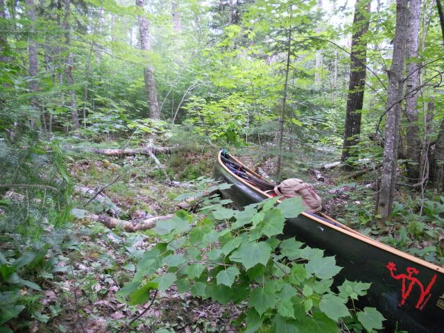
Many people I’ve talked with somehow take a wrong turn on this portage and end up back at the unnamed, and from there either head to Dell or back to Shade. So I decide to take some pictures this afternoon to help navigate this tricky area. The portage starts from the unnamed climbing rather steeply up some rocks and boulders. It continues uphill and begins to wind incessantly through a thick, overgrown trail. Easy enough with packs, but a pain in the butt with the canoe. Several times I had to struggle backing up the Northwind when I’d run the bow into the thick forest during sharp turns. After about 150 yards, the path levels and winds down a gradual slope until the forest opens to a grassy bog area. Stay to the western side of the bog. There’s several different “foot” paths on this western edge, some wetter than others. After about 50 yards, you’ll reach the NW edge of the bog where you either turn right (eastward) and cross the bog or turn left (westward) and head back into the forest.

I call this point the junction where I’ll drop my load and head back for the canoe.

Here's the wrong path to the left of the junction that leads back into the forest and returns to the unnamed lake. Looks inviting, doesn't it? Don't go this way.

From the junction looking eastward, you’ll see the huge amount of corduroy for about 50 yards that ends next to a 15 foot high cliff of rock where the portage trail hits hard ground and continues up and over to Grey.

You have to cross the bog to get to Grey. Instead of using all the corduroy, I start left of it and hop along the tufts of waist-high grass until I’m about 15 yards from the rock cliff. Then I maneuver back onto the corduroy and carefully step my way to dry land. Last year, my son lost his balance and went over his knee in the muck. Others I’ve heard have gone deeper. Here’s a photo from near the cliff wall looking back across the bog with the junction at the far treeline center-right.

It’s late afternoon as I enter Grey, a pretty little lake with numerous islands. I check out a campsite on the western side of the large island and it just doesn’t have any appeal. I decide to take the 580 yard carry into Yum Yum, but I have some trouble finding the take-out as there is no apparent path on the shoreline. The only possibility from the map appears to be a large sloping granite slab. I park the canoe and walk up the granite slope and sure enough, there is a portage path. You just can’t see it from the water. This portage goes up and up and up and then steeply down into Yum Yum. It will definitely get your heart racing. The two shorter portages from NE side of Grey into Yum Yum via Armin seem much easier in my mind. Once on Yum Yum, I check out the clifftop campsite, but the horseflies and deerflies are all over the place. So, despite my growing fatigue, I paddle up Yum Yum and take the final portage into Shan Walshe. If the island campsite is occupied, I’m not sure what I’ll do.

The campsite’s open and I thank my lucky stars. All that is left of the moose skull from a couple years ago is a few vertebrae. I take some time to sit and relax before setting up the tent and washing out my Abyss boots and socks. It’s a simple Mountain House chicken stew for dinner that really hits the spot. As the sun dips below the treeline, I secure the canoe, arrange the packs and gear under my poncho, and lay the SPOT out on the ledgerock to send the message that I’m ok after a long day of travel. I had planned on staying here on Days 2 and 3, so I’m already a day ahead of schedule. No need to do anything else tonight. My body is really tired and a little sore, including my knee. I hit the sleeping bag as the stars begin to shine. I wonder how I’ll feel in the morning as I drift into a hard sleep.

Day 2. Layover on Shan Walshe

I wake about 7:00 and lay there a bit, yawning and stretching, hearing the pop and crack of a couple bones and tendons. I actually feel pretty good, better than I thought I would. The knee doesn’t seem to ache at all. I stumble out of the tent and lazily boil some water for coffee to go with some Special K cereal and powdered milk. Then I eye the firepit. What a sickly sight! The previous occupants had stuffed rocks all over the pit area, probably trying to build a rock grate to hold the foil for their baked fish. Only they were too lazy to take the foil out with them when they left. Pigs! After cleaning up the mess and rearranging the stones to make a good reflecting firepit. I scrub the black soot from my hands and put up the tarp to provide some additional shade and protection from any possible rain. I simply love my 12X12 CCS tarp.

It’s late morning when I finally gather my fishing gear and hit the water. The wind has become quite brisk from the west, which makes the fishing on Shan and Yum Yum challenging. A couple hours yield only a few smallies and pike and no lake trout. I tie the canoe up on the shore near a burn area and grab several small seasoned pine logs to cut and split for an evening fire. I drift back to the island campsite and carry the logs up near a blown down jack pine on the edge of the campsite. Yesterday’s long haul from Prairie Portage has caught up with me so I crawl into the tent for a well-deserved nap. Not sure how long I slept, but I’m rudely awakened to the screeching of a raven and the chattering of a red squirrel arguing about who knows what.

The westerly wind is still blowing waves across the lake, so I go ahead and cut and split enough wood for a long evening fire. I hope the wind dies so I can bake a pizza or laker tonight. As the sun begins its late afternoon descent I head out to try for a trout again. The wind makes it difficult to control the canoe even while trolling, and after 30 minutes with no strikes I say heck with it and paddle up to the northern reaches of Shan Walshe for the first time. The eastern shoreline is still scarred from a massive fire that obliterated many of the large pines a few years ago. But many pines survived and the understory is finally starting to green up with a new forest. At the northern end, I head to the protected western shoreline where I land several nice smallmouth, the largest at 17.5 inches. By the time I return to the campsite, I’m tired of battling the wind which is still too strong to use the reflector oven. I instead boil up some hot and sour soup with veggies, melba crackers, pistachios, tootsie rolls and a vodka/gatorade. A few mosquitos buzz by every now and then, but not enough to ruin a relaxing dinner with a great evening campfire. I sleep really well tonight.

Day 3. Shan Walshe to Kahshahpiwi via Yum Yum.

Total Miles - 7.4; 2 Portages (1360 yards)


View 2011 Day 3 in a larger map

I wake up about 6:00 am to the screeching of the raven and the chattering of 2 red squirrels that seemed to be right above my tent. “You guys sound like my students!”, I yell out! It became quite cool during the night which caused me to fully zip my new Montbell ultralight down bag. I really like this bag, which is about half the size and weight of my previous synthetic bag. I’ve never slept well in mummy-style bags, but Montbell said this bag has a patented stretch system. It actually works as advertised, stretching when I roll from side to side, making it feel more like a regular bag. And, it’s toasty warm.

I actually thought about laying over here for another day, but as I roll out of the tent to start the morning coffee, I decide to head over to Kashahpiwi. As the coffee brews, I take down the tent and fire up the little Primus stove and quickly fry two fresh eggs with pre-cooked bacon. It’s a cool overcast morning that hints of possible showers. I’m hoping any rain will hold off until after the Yum Yum portage because I’ve heard the steep cliff wall is hard enough to scale up in dry conditions. Just before loading up the canoe, I take in the nice view to the north of Shan Walshe.

And next to the canoe is this pretty wild blue iris that’s just about finished blooming.

The portage back into Yum Yum is really cool. Large old cedars and pines shadow the entire portage along a creek, making it seem darker than it really is and primordial in feel. I notice wolf scat along this portage every time I come through here.

As I paddle down the length of Yum Yum into a light breeze, I’m amazed at the steep cliffs that line both sides of this narrow lake. The pines and cedars cling to the slopes and I’m always amazed how the roots of the trees can be strong enough to latch onto the cracks and crevices of the rock to keep the tree from crashing down the steep slopes.

It’s mid-morning when I reach the take-out in the far SW cove of Yum Yum. I first grab the heavy pack and small front portage pack to see how long it is to the base of the cliff wall. The path itself is fairly nice and begins a gradual ascent for a couple hundred yards. The narrow path becomes a shallow gorge about shin deep, created by the years of footsteps and water than compacted and eroded the soil. Then, the base of the cliff appears. I drop the small pack and pause a few moments to assess the rock face. Beginning with a few small steps, I realize the traction is quite good and simply walk up the rock face about 40 feet. The path then continues to rise and wind up and over several more large boulders veering to the right. I drop the heavy pack on top of one of the boulders and head back down to retrieve the canoe. I find going down the cliff face is more demanding than going up and I fear a slip will lead to me cartwheeling out of control down the rock face. But I make it down without incident. I retrieve the canoe and when I return to the base of the wall, I drop the canoe and take a picture (which doesn’t do justice to the steepness of this rock wall).

I grab the two smaller packs and leapfrog past the heavy pack and up to the crest of the portage, where it overlooks a meadow valley. Blueberries are beginning to ripen and I gorge on a couple handfuls. As I continue to leapfrog my gear, the path rises a bit more and then descends into a boggy area with several areas of mud and corduroy. At one point, I carry the canoe past the packs for a ways when all of a sudden, the path simply stops and I find I’m surrounded by numerous fallen birch trees. I stand dumbfounded with the canoe perched on my head. I don’t recall reading anything about a bushwhack through the bog? After a few more confusing seconds, I drop the canoe and head back towards the packs.

After backtracking about 30 feet, I notice the path has a sharp 120 degree fork to the left as you’re coming from Yum Yum. I completely missed it with the canoe on my head. From here, the trail rises for a bit more before mercifully beginning its very steep lengthy descent into Kahshahpiwi. When I finally get everything to Kahs, I’m pretty beat and thinking that was one long 1230 yards. Total time was about 3 hours, which included about 30 minutes resting and extracting the canoe from the dead end. I’ve heard people say the portage from McNeice into Kahshahpiwi seems longer and more difficult, but I beg to differ. The Yum Yum portage is the harder of the two, although the famous cliff wall seems a bit overrated. Then again, on a wet day, the Yum Yum portage would be a real monster.

Once back on the water, I take in the view of the SE bay of Kahshahpiwi and notice some blue sky trying to break into the overcast skies.

When I paddle into the main body of Kahshahpiwi, I unlash my fishing rods and start trolling the western shoreline into a freshening northerly breeze. How is it that I paddle SW into the wind on Yum Yum and then when I turn north on Kahshahpiwi I’m still paddling into the wind? Within 15 minutes, I land a couple of nice smallmouth, a walleye, and a northern pike. I continue northward and round a point which borders a small cove. I stay in the deeper water just outside the cove. The pole bends sharply, a nice strike! For a minute or two, I think it must be a walleye as it tries to stay deep. But as I get him near the surface, I realize it’s a fat 18-inch lake trout, a perfect size for dinner! I park the canoe and carve out two nice fillets and put them in a ziplock bag. Looking at the steep shoreline, I notice several small red pines blown down on the upslope. So I tie off the canoe and scramble up and down the slope collecting a few seasoned pine logs for cutting and splitting. Baked lake trout here we come!

Wow. Four different species in about 30 minutes on the same lure – a Rapala deep husky jerk, glass perch. As I begin trolling again, the north wind has increased noticeably, so I reel up and paddle hard to the mid-lake island. I rest a few minutes and then battle again to the next island that hoolds two decent campsites, one with small coves on the north and south side of the campsite. As near the leeward southern cove, I hear voices and a white tarp comes into view. I sit quietly and mull whether to continue on to the north or head to campsite on the other side of the island. “North”, I say to myself. I struggle into the wind for another 1/3 of a mile and ease my way into a protected cove where a rocky point juts out from the steep eastern shoreline. I chew some Slim Jims and peanut M&Ms and pull out the map. I see a campsite another 1/3 mile to the north. For some reason I thought earlier this was the one that was burned over, but realize that one is further north. As I pull back into the wind, I eye the area and it appears to have escaped the fire. When I get closer, I see a nice ledgerock landing almost totally out of the wind. I tie the canoe and walk up the steep slope for about 60 feet. WOW! I find a grand campsite, high above the water, with a great view to the south. The firepit area sits on a large, flat, s

Part 2 of 3


quare-shaped granite slab about 15 feet on each side. Sitting logs are on three sides and someone had brought up a bunch of flat rocks and constructed a couple of coffee tables in the firepit area. So cool!

The wind is still blowing moderately from the north, but this south-facing site is mostly calm even though it’s high above the water. I explore the several walking paths and find outstanding views of north Kahshahpiwi. It was a good thing I gathered some wood on the paddle up here, because there is no firewood near this site. It starts to sprinkle, so I quickly put up the tarp and relax for an hour or so with a cigar and a drink. By late-afternoon, the sprinkles subside so I erect the tent and begin cutting and splitting enough wood to bake the trout. As the fire starts to burn, I lay the fillets on foil, rub in my special Cajun spice mix, and top it with some butter.

Once the coal bed is ready, the foil-wrapped fillets go on the grill and I cook up some baby red smashers and mixed veggies. Nothing quite beats the first lake trout dinner on a Quetico solo!

I get everything cleaned and secured for the night. With enough sunlight still remaining, I find a path that leads down the granite bluff and near the water’s edge facing south. There’s some really nice sitting areas down here. I watch hundreds upon hundreds of water bugs congregate into two distinct groups in the eddy of the granite bluff. The two groups never converge into one and remain separated by about 10 feet. I watch them and each seems to pulsate, alternating from a tight dark mass only to explode out, looking like a watery version of the Milky Way. As the wind calms and the sky darkens, I climb back up to the campsite and into the tent. I don’t know what tomorrow holds. Physically, I’m feeling really good. I begin to think about laying over a day, heading west over to Marj like I had planned, or pushing north and making a run to Camel, with the outrageous thought of bushwhacking into Hoare, bad knee and all. That's when I realize I left my McKenzie maps of the Camel route back in the car. All I have is my trusty Chrismar map and my memory. I’ve never tripped in Quetico before with just the Chrismar, but it should be doable. And I think I can remember where most of the campsites are and the details of the bushwhack into Hoare and the Death March. These thoughts continue to bang around in my head as I warm up in my sleeping bag. Just before falling asleep, I decide I’ll move in the morning. I have plenty of days left and am in no real hurry. If the wind is down, I'll head north.

Day 4. Kahshahpiwi to Baird via Heronshaw and Metacryst

Total Miles - 14.8; 7 Portages (1660 yards)


View 2011 Day 4 in a larger map

During the wee hours of the morning, I wake up to the sound of "ploosh" as if some big rock had been thrown off the nearby cliff into the deep water. "What is making that sound?" It went on for about 20 minutes, with a “ploosh” every few minutes or so. It wasn't the distinct slap of a beaver tail, and it was too low pitched to be a small fish. Maybe some big lakers feeding on the surface in the middle of the night in mid-July? Maybe some playful otters competing in a cliff-diving contest? Ploosh. 9.5! Ploosh. 9.7! Ploosh. Yes! That’s a 10! I fall back asleep and wake up at first light to a cool, calm, partly cloudy sky. The moon is still visible as sunlight begins to shed detail on an eastern shoreline still showing the scars from a massive fire that ripped through it a few years ago.

It’s a bit after 8:00 as I finish my coffee and cereal. The wind can’t seem to make up its mind. It seems to come from the south, then the north, then the west. I see some high cirrus rolling in from the western horizon. Time to pack up and head north. I quickly reach the narrows heading to the northernmost area of Kahshahpiwi.

The short portage into Keefer follows a scenic little set of rapids. I look back at the outflow into Keefer,

This place definitely looks fishy so I cast my spinnerbait at the base of the outflow several times. Nothing. I grab the deep husky jerk and begin trolling north towards the main body of Keefer. Still nothing. The eastern shoreline is quite steep and picturesque with numerous steep rock faces studded with trees sprouting from hidden cracks and crevices in the rock. As I near the main expanse of Keefer, it starts. A little wisp at first. Then another. Getting stronger. Now it’s pretty steady. You’ve got to be kidding me! I put away the rods, grab the yak paddle and begin a slow, methodical paddle, into a modest northerly breeze. I think to myself, “Hey, it’s only about 12 more miles to Baird”. And the wind isn’t that strong. Yet. I’m beginning to not like the Quetico gods.

I reach the 320 yard portage into Sark in about an hour. Not bad. Roughly 3 mph soloing into a modest breeze. The take-out requires a bit of boulder hopping before getting to the main path, which is rocky and rooty, but well worn.

The portage parallels a scenic creek that has some quite noisy rapids as the rushing water crashes towards Sark.

Just before paddling away from the put-in, I see algae flowing just under the surface of the moving water and the grand northerly view of Sark..

As I munch on some trail mix and wash it down with some water, I notice that Sark, like Keefer, is a long, narrow lake lined on the east and west by rugged cliffs and numerous exposed rocky bluffs. I wonder is any of these rock facings have a nickname like Warrior Hill on LLC?

A mile or so to the north I see the paddle of a canoe, then another canoe, and then another. They appear to be heading north as well. I dig in to see if I can catch them before the portage into Cairn. As I near the northern end Sark, I see the 3 canoes have stopped near the end of the lake. They appear to be discussing where to go next. I hook to the right and glide past them. As I near the Cairn portage, I run aground on a shallow rock. DOH! I step out of the canoe, slide it off the rock and wade over to the take-out. The party behind has paddled up and now wait patiently as I ground my heavier packs on shore away from the takeout. Then I hoist up the canoe and head down the 470 yard mostly downhill and well-worn trail. When I get ready to resume my paddle up Cairn, I visit with this group of a couple adults and several teens. They are from Texas and are being guided by a young lady from one of the local outfitters. They’re planning to camp on Cairn and then head over to Kawnipi before heading back to Prairie Portage via Agnes. The boys ask about catching fish, so I give them some tips on trolling the shoreline drop-offs of Kawnipi and tell them they’ll most likely catch some nice fish. One of the boys tells me he’s never caught a smallmouth bass and wonders what it’s like. I smile and tell him to get ready for the fight of his life as his eyes widen with anticipation. I push off and pull a snack out of my pack as I glide away. Then I turn around and take a picture of the Texas crew putting in on Cairn.

Luckily, as I paddle up Cairn, the wind begins to calm. Cairn is a strikingly beautiful lake dotted with rocky cliffs and islands, large and small. On the western shore I spot a really strange looking rock formation. Now, you tell me. Looks like a giant elephant or perhaps a stegosaurus, doesn’t it?

The portages into Heronshaw and Metacryst are short and easy. The portage from Metacryst into the unnamed on the way to Baird is not quite so simple. “Holy crap, this is a rocky portage!” There is also a large blowdown about 2/3 up the trail that was laying horizontally across the trail about head high. As I near the obstacle with the canoe, I’m prepared for it because I know it’s coming up fast. BONK!! I nail the trunk dead on with the bow. I take a couple steps backward, hunch down and squeeze the bow under the tree on the far left side of the path. As I get all the way under and through, I stand up thinking, “Ahh, this is so cool!” A few more steps and BAM! I run the bow right into a big old white pine, dead center, that stops me cold. “Oh, crap!” Thank God I don’t move very fast with the canoe or I would have smashed it. Anyway, I continue on and carefully boulder hop my way to end of the portage and into the unnamed south of Baird. It sure is hard to enjoy a scenic portage while trying to keep from breaking an ankle or kneecap on so many slippery boulders and rocks. Near the end of the portage, a large almost 1.5 foot diameter white pine had fallen across the trail, but thankfully, the portage crews had sawed through it to clear the trail. As I lay the canoe in the water, I noticed a swarm of blooming wild blue iris.

The portage from the unnamed to Baird isn’t too long, maybe 150 yards. It goes slightly uphill on a decent path until the forest literally engulfs the path. For the next 30 yards or so, I’m relegated to watching my feet so I can keep on the trail, along the way hopping over a couple hidden jack pines that had fallen down across the path.

The short portage ends with a crazy steep drop into Baird. We’re talking at least 45 degrees, probably more. If it were wet, I’d be on my butt sliding down the dropoff trying not to destroy the canoe. I finally get on Baird and thank the good Lord. “No more dang portages!” I yell out to nobody. The island campsite is a couple hundred yards straight ahead and I sure hope nobody else is on this supposedly haunted lake. It’s open! And quite nice! It has a large flat ledgerock landing with a great view to the east. You head up to the first tier where the firepit is located with some large relatively flat granite slabs that sit about 20 feet above the water and provide spectacular views to the west. A little further up the hill is a nice tent pad. And then at the top of the rise, which is on northern side of the island, you get some great views. The island is comprised almost entirely of young and middle-aged red pine.

The ground all over the island is littered with several inches of dry, crunchy, pine duff. Various fungi punch their way through the duff.

The sun is still above the trees, so I take a quick dip in the water swim to wash off the grime of the portages, rinse out the boots and socks, grab my chair and sit down to relax on the flat granite slab near the firepit. I decide a triple decker PBJ with a Gatorade and a cigar would really be good about now. And it was! As the sun begins to settle below the treeline, I set up the tent, secure all the gear under my poncho, and return to my chair to gaze at the sunset. In the calmness, the loons begin their wild calls that echo all over the lake. Easily the best evening of my trip so far.

Day 5. Baird to Camel via Cutty Creek

Total Miles – 9.1; 4 Portages (275 yards)


View 2011 Day 5 in a larger map

It’s about 6:00 as I roll out of the tent very sore. I didn’t sleep well, probably because Baird is haunted. “Gonna be a Motrin morning”, I say to myself. After a quick breakfast and some coffee, I pack up the gear and prepare to push off for the Cutty Creek and Camel Lake. I feel a light westerly breeze as high clouds begin to fill the far southern and western skylines. In no real hurry, I decide to take a few pictures before pushing off. Here’s a shot of my canoe setup looking westward across Baird towards Cutty Creek.

One of things I’ve packed over the last several trips are 18oz JIF peanut butter jars. I usually put cereal or crackers in them, and when they become empty, they’re ideal for packing out the garbage.

I used a Steripen purifier for the first time ever instead of my usual Katadyn filter. It works great, purifying about 6 liters of water per day (about 75 seconds per liter). Just make sure you’ve got the clear nalgene bottles so when it’s on you can see the UV light from the Steripen. Here’s me prior to departing for Cutty Creek purifying a couple of liters of water that would last until I reach Camel Lake.

A few folks asked about my kitchen pack set up. 2 Aluminum plates, an 8-in GSI non-stick aluminum skillet, a 2-quart Snow Peak titanium pot, 2-quart MRS Blacklite non-stick pot, a Primus stove with an 8 oz can of butane/propane fuel, and a GSI plastic bowl. All nest together with lightweight towels in a small mesh bag, shown here on my 3-legged camp chair from REI.

I shove off and turn west. Even though it has a haunting reputation, Baird is quite scenic. The portage at the west end of Baird is located to the left of a small creek clogged with various sized pieces of timber.

The portage trail was well used and mostly downhill, but several blowdowns made for a few acrobatic moments. The tranquil Cutty Creek is one of the most pleasant morning paddles I’ve had in Quetico, except for the horseflies. I literally HATE horseflies! But the creek itself has a variety of flora: pine-covered sides that rise up into the hills, marsh grasses, lily pads and the like. No moose today, though.

The creek meanders back and forth and finally begins to open as you near the cliffs that signal the entrance to Cub. From here, you turn left and follow the northern shoreline. Of course, I bet myself $100 that I’d be paddling into the wind, and of course, I won that bet. The wind was blowing right into my face. Again.

The next portage from Cub is one of the rare mismarks on the Chrismar map. You can actually paddle right back into the creek and there’s a short, maybe 25 yard portage on the right. After a short paddle, scenic Eag comes into view. Paddling northward through a narrows and turning to the west, the next short carry is also on the right of the creek. The creek is loaded with lily pads, marsh grasses, and, of course, horseflies. I count 14 buzzing around my canoe as I reenter the creek. Needless to say, I become quite adept at holding my flyswatter while paddling and I murder at least 20 of them before reaching the final portage of the day. This one is also on the right on a well-used sometimes rocky trail. I meet a nice couple here who are on Day 16 of a 21-day loop out of Nym. They’ve been on Cutty Creek several times before and I remark how lovely the area is. They provide some detailed info on the Delahey Death March which tracks closely with my memory of posts by other paddlers. We part ways and I put the canoe into the narrow creek channel that winds it way back and forth. Fortunately, water levels were high enough that navigating through the narrow passages was no problem.

Finally, the creek begins to widen and straighten as Camel Lake comes into view.

As I make my way across Camel, the wind has shifted and is now from the south. I notice numerous tall scorched pine trunks that resemble long black spikes as they poke out from the deep green forest understory of the southern and western shorelines. I stop for lunch at a rarely-used little campsite on the western shoreline just above the narrow chute that leads to the southernmost waters of Camel. I leisurely eat an energy bar, trail mix, M&Ms and Gatorade. I decide to paddle through the chute and hug the western shoreline down to the creek area that would mark the way into Hoare Lake. As I paddle along, I notice how the forest has changed from the pictures I’ve seen from the early 70s. Back then, fires had consumed much of the forest, leaving it quite open. Today, it is thick with undergrowth. Here’s a good picture of the western shoreline from the lake.

The creek entrance leading to Hoare Lake at the center of the photo is actually a large marsh area guarded by shoulder high grasses. You can see a big cedar leaning precariously over the water on the right. I stop here first, tie off the canoe, and try to make my way through the forest for about 40 yards. Wow. Really thick. Virtually impassable with a canoe. Next I paddle past the cedar for about 40 yards, run the canoe into the tall grass on the northern edge of the marsh, and step out onto the shoulder high grass. As I take steps through the tall grass, I’m able to stay mostly dry. Every now and then, the tufts give way and I sink below the ankles. I follow a couple of game trails on the northern edge of the marsh and after about 75 yards I come to the 10-foot wide creek where water trickles through the rocks and boulders into the marsh. From here, I boulder hop another 100 yards or so up the creek, then move into the forest on the right and bob and weave my way through, over, and under the forest vegetation that follows the creekbed. After about 50 yards, I arrive at another open marsh area of tall grasses. The going is not easy and would be much harder with packs and canoes. I backtrack to the canoe and check the time. 45 minutes. Wow. I estimate that it would take me at least 7

Part 3 of 3


r 8 hours to double portage to Hoare Lake. Not happening today. I push the canoe back out of the grass and paddle to the eastern shore of Camel to a small 2-star campsite. Not bad. Flat ledgerock landing, average firepit, and one nice soft tent pad nestled in amongst a mature red pine and several 6-foot tall young pines. This’ll work for tonight.

I unload the gear, take a quick swim, wash and hang the dirty clothes and set up the tent. When I say the tent pad is nestled in amongst the pine, I’m not kidding. But it is a sweet pad on soft pine duff.

I boil up some water and have a hearty hot and sour vegetable soup dinner. The wind is still steady from the south as I gaze westward across the lake to the marsh area that leads to Hoare. I’ve been thinking about Hoare for two years, and now that I’m so close, I try to convince myself to head in there tomorrow. After one vodka/Gatorade, I’m going to do it. After a second drink, I know I’m crazy. I recall that oft used quote, “Discretion is the better part of valor” and realize that with the Death March still looming, my knee not at 100 percent, and being solo, I’d better leave Hoare Lake for another year. Tomorrow I head to Delahey and I fall asleep hoping the south wind dies down.

Day 6. Camel to Delahey.

Total Miles- 7.0; 5 portages (1110 yards; 3rd portage was able to paddle through)


View 2011 Day 6 in a larger map

I sleep really well and wake up at 5:00 to the soft pitter patter of rain on the tent fly. How nice. How relaxing. I’m half asleep when I realize that I went to bed thinking there’s no chance of rain. So I left the packs out without covering them with the tarp or poncho. The gear!! I race out of the tent, trip over one of the guy lines, rip the small tarp and rain suit out of the big pack, grab the chair and the other packs and scramble to get everything under the tarp. It’s not a hard rain, more like a hard drizzle, but by the time I get back in the tent, my shirt and long johns are damp. So I lay on the pad to let them dry as I doze in and out for the next 90 minutes. It doesn’t rain much, but everything outside the tent is damp when I roll out and get everything ready for the day’s travel to Delahey. While finishing my morning coffee, I watch a yellow canoe with two paddlers glide north along the far western shoreline. Wow. If they came from Veron or Delahey, they must have gotten a real early start. They’re moving along pretty quick when I notice the wind. It’s coming from the SE. Of course! That’s the way I’m heading to get to Veron. I curse the Quetico gods.

I reach the SE end of Camel where the take-out to Veron is guarded by two large distinctive waist-high stumps amidst some large boulders and other smaller rocks.

The730 yard portage is a lot tougher than I expected, even though I knew it was mostly uphill. I guess I didn’t believe it was that steep and that much uphill. It is. And it never seemed to go downhill much, not even near the end. A couple of blowdowns around the midway point didn’t help matters either. One of the blowdowns was a birch tree that was about shoulder high on the right and knee high on the left. The thick forest made it virtually impossible to bushwhack around it. Studying the scene, I’m pretty sure I can hunch down and get under the right side with the canoe instead of dropping and dragging the canoe along the ground. Okay. Here we go. I get as low as I can without crawling, walking like a duck with a canoe on its head. I inch my way along and about half way through something hits the canoe and it slips off my right shoulder. Instantly, the canoe is taking my head off with it. My head pops out, the canoe bangs into the ground, and I’m laying there sprawled out. Like a dead duck. “Well that sure as hell didn’t work!” I yell out. I gather my senses, swear a couple times, stand up and drag the canoe under the tree. Well, at least I didn’t hurt myself, just a scrape or two on the shoulders and knees. A couple of deep breaths, I hoist the canoe and stumble away to the end of the portage.

After a short 50 yard paddle upstream, the portage on the left takes me around two nice sets of rapids.

From the put-in at the top of the rapids, the creek meanders in a general SE direction which. Of course, the wind is blowing pretty stiffly from the SE at this time, enough to take most of the fun out of paddling this scenic area. As the creek widens, I approach the 3rd portage of the day into an small pond and am surprised to find I can just paddle though the narrow slot in the high water conditions. The 4th short portage into Veron is on the left and follows up the creek. Once on Veron, the wind has really picked up and is whistling right into my face. I hug the eastern shoreline, and then shoot across the channel for the calmer water behind the large island at the opening to the main body of the Lake. From here, I quarter into 1-foot rollers as I make my way to the calmer southern shore.

As I near the Delahey portage, I see the unique sight of water spewing into Veron from the thick forest. The outflow of the creek from Delahey. I wish I had remembered my notes that I left in the car, as I didn’t even think to drop a lure into this fine fishing hole that contains bass, walleye and pike.

The portage into Delahey is up a gradual slope. The thing I recall is the smell on the first half. Like a sewage plant. Phew! Really strange. I’m on Delahey just before noon. The sun is trying to peek out and I can almost make out some shadows. I follow the narrow channel and begin to daydream in the now quiet waters. Not sure what I was dreaming about but I miss the turn to the left and find myself one dead end bay to the west. I backtrack and paddle south down the correct channel, navigating through some submerged rocks. In low water conditions, scraping the hull would probably be par for the course here. As Delahey opens wide, the wind is still blowing from the SE so I make my way south towards the protection of the big mid-lake island. Since I didn’t bring my notes, I couldn’t remember exactly which island contained to Olive Jar, but I knew it wasn’t the big island. I turn west and check out the next smaller island. Nothing here. So I continue west to the next island. I see a the top of a tree trunk laying on the ground on the top of a rise as I approach the island. I glide with the wind and waves into a shallow cove and land the canoe on some slippery ledgerock.

It’s almost 1:00 p.m. I make sure the canoe won’t go anywhere and then make my way up the slope about 25 yards. As I come over the rise, I see the tree trunks layed out in a rectangular sitting area overlooking the lake. A few more steps and, “There it is. Oh, my God!” The reddish-brown colored Olive Jar sitting on a hand-made wooden chair. To my right is a well-built firepit and a little further a nice large area for tents, wind-protected and surrounded by tall, mostly red pines. After 6 days and 52 miles of travel into the wind, I am finally here! Tired. Relieved. Happy. Fantastic!

I unload the gear, set up the tent, and erect the tarp above the sitting area. Good thing I brought extra tarp rope as some of the pines I needed to use were up to 45 feet away. I set it up like a raised teepee, center up high, corners down and the midpoint of the sides up, providing excellent views all around. Then I sit down for a celebratory cigar. As I’m relaxing, I open the Olive Jar. It’s packed full, and I mean full. Most of the ziplocks are from recent years, mainly from various youth camps and guided boys and girls groups. I have to dig down to the bottom to find the older notes from the 80s and 90s. I read a few notes and then take a break to explore the island. I notice the variety of flora around the campsite. I can’t recall another location in Quetico with so many different types of plants, various types of flowers, dandelions, different berry bushes, and several plants I have no idea about. Buzzing all over are bees and other flying insects. As I return to read some more, some the flying marauders get too close for my comfort zone, so I put up my screen room under the tarp. This thing is so cool. It’s permethrin-treated mosquito netting about 5-feet high, 7 feet wide and 5 feet deep and weighs almost nothing. It makes my little sitting area even better by keeping the bothersome bugs at bay. Now I can enjoy reading in peace!

My stomach rumbles loudly and I realize how hungry I am. I have a craving for fried fish on buttered whole wheat bread, a Knorr rotini and vegetable pasta side dish and some tootsie rolls. So I grab my fishing rods and cruise clockwise around the island. The wind seems to be waning a bit and as I near the leeward side of the island, I land a fat 14-in smallie. A minute later I catch another one. Time for dinner.

Back in the screen room I read some more from the Olive Jar. At some point in the past, someone had not closed the lid completely and many of the notes from the 1980s and 90s got wet. Today, many are difficult to read and others are falling apart. I find the notes from Shan Walshe and Julie Copperman, dated from the 1980s . Someone was kind enough to place them in a waterproof map case, and you may be able to read the notes from these photos.

It’s almost 10:30 and I can’t keep my eyes open any longer. I gaze over to the east and see a huge full moon, yellowish white, rise quickly above the treeline only to be consumed by dark grey stratus clouds. The wind is still noticeable as I call it a night and hit the sack.

Day 7. Layover on Delahey

Even though I’m tired, my eyes pop open at 5:30 and I couldn’t go back to sleep for some reason. So I just lay there and start to read some more notes from the jar. I’m now getting into the 1990s and earlier notes, and for me, these are the most interesting of the bunch. When I finally exit the tent, it looks like fog or mist has enveloped the east side of the lake, quite a change from last night when it was almost clear with a few banks of stratus clouds here and there.

After my morning coffee, I get the urge to go fishing. The wind is light from the south and I load up the rods and fishing gear and troll east toward the big island hoping to hook into a good laker. I near the island and my rod bends from a vicious strike. I grab the rod and a huge smallie rockets above the surface about 75 feet behind the canoe. It dives down as I begin reeling, then it bolts above the surface again. A third leap and he’s gone. Dang! That one was no doubt a trophy at or above 20 inches. I continue to cruise the south side of the island and land a couple 16 inch smallies then head north along the eastern shoreline of the island. I get another big strike and after about 5 minutes, finally get a thick 33-in northern into the canoe. I can’t recall catching one of this length that had such a wide girth. No wonder it fought bigger than it was. I spend an hour casting in and around the various rock structure landing several more smallies and a couple more pike, none of trophy size. As the sun rises higher in the sky, I paddle across to the southern shoreline of Delahey looking for some good fallen red or white pine for the evening fire. This side of the lake is dominated by jack pine, with a little bit of birch. In fact, the Olive Jar island is about the only place I visited that was mostly red pine, everywhere else was jack pine. Up on one of the open rocky bluffs, I find some decent jack pine logs and pick a couple handfuls of fresh blueberries before heading back to the campsite. It’s early afternoon and the sun is starting to peek out in the patches of blue sky. Looks to be turning into a nice, lazy afternoon. I think I’ll be departing tomorrow for the Death March, so the rest will no doubt help.

Early evening. I can’t wait for my first pizza of this trip, one of my favorite foods on Quetico trips. With a lazy afternoon behind me and a cooperating wind direction, I get the fire going. The crust is warming near the fire and to make the sauce I mix together some tomato powder and various spices. Then on goes the rehydrated tomatoes and mushrooms, pepperoni sticks and to top it all off, mozzarella cheese. Delicious!

I was hoping for a calm evening, but the southerly winds seems to blowing harder than at any time during the day. No fishing for me tonight as it’s just too much work trying to fish in the wind as a solo paddler. I’ve eventually finish reading all the notes. Those from the 1980s and early 1990s were quite special. One of the most humorous was from some professors from a Northern Illinois University discussing the theory of Quetico’s Giant Giraffe that was conceived from the vagina of Quetico’s granite rock and rules the Quetico. Lots of good info about what you need to do to appease the giraffe along with advice regarding sex and drugs and canoeing. I actually said a little prayer to the Giant Giraffe in hopes he’d make for easier paddling back to Prairie Portage, but later during the trip I said to hell with the damn giraffe when I had to fight through big winds on Sarah Lake. There were several notes describing in graphic detail the horrific Death March in the 80s and early 90s. Many referenced the “Bog Monster” with tales of sinking up to their waists in stinky mudbaths, getting separated from their mates, and bushwhacking through the better part of the day because there were no clear trails. Simply amazing stuff.

As darkness and cooler air settle over the lake, I pack everything back into the Olive Jar and secure all my gear for the night. The sky is almost clear and the water calm as I take in the view of Delahey’s western horizon. I hit the tent at 10:30. In the morning, the Death March and “Bog Monster” await.


    Back to Trip Report Main Menu


Copyright © 2002 - 2010 www.bwca.com - Legal Notice